Irrigation data comparison focuses on crop-specific irrigated hotspots (areas with high irrigation concentration) using three datasets – the Land Use/ Cover Area Frame Statistical Survey (LUCAS) irrigated points with 16 crop types in 2012, 2015,…
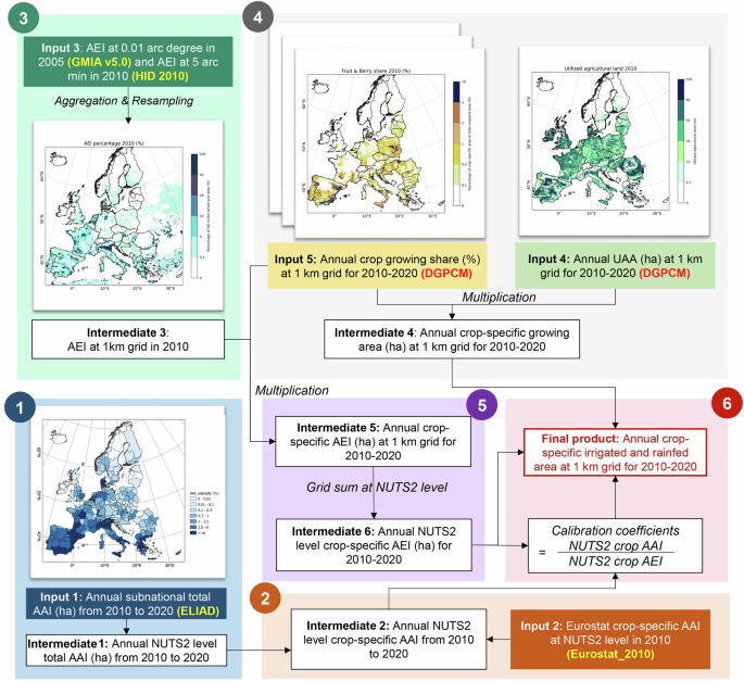
ECIRA – European crop-specific irrigated area at 1 km resolution annually from 2010 to 2020